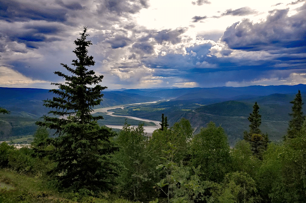
WE DIDN’T GO TO THE YUKON with the plan of traveling up the Dempster. In fact, we had driven by the intersection on the way to Dawson City without the slightest idea of what it was or that we would be back the next day. Pamela and I aren’t town people, but Dawson City (pop. 1,375) was where we were going to catch the ferry across the Yukon River to the Top-of-the-World Road to Chicken, Alaska – population 15. In town we spotted a visitor information center for the Northwest Territory. We got talking to the lady who ran the center. She was a native from Inuvik. By the time she asked us a lot of questions about our life-style she decided that we just had to do the Dempster. Okay, so there were only three gas stations on the 1,000 mile road about 250 miles apart. Could our big 6.4L Hemi with a 1,500 pound payload do 250 miles? Lots of questions. Lots of concerns. But her description of the road and her hometown of Inuvik made the challenge a must-do.
Back at the intersection where we had paused after filling with gasoline from self-service tanks at the intersection, we looked up the narrow gravel road ahead of us. Once I pushed the throttle we were committed. This wasn’t like an amusement ride that you can scream and someone will stop it to let you off. This was 1,000 miles of wilderness at an average of 31.5 miles per hour with one way in and one way out.

The absolute splendor and magnitude of our surroundings didn’t give us time to fear or fret. By the time I had driven a few hours I realized that the road, while gravel, was exceptionally good and well maintained. We stopped at Eagle Nest, at about the 250 mile point, for gasoline. I was absolutely thrilled that we had made the distance without trouble. We drove to a government camp just north of the Arctic Circle for our first night. Except for those at Eagle Nest, we hadn’t seen people or vehicles all day. Obviously we were the only ones at the camp.
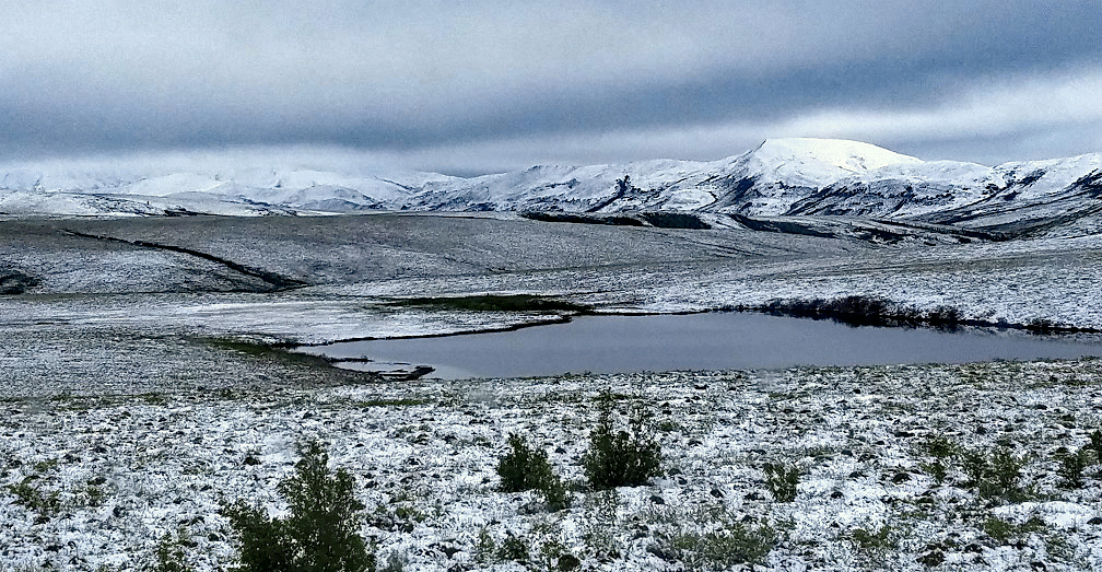
I don’t know what I was thinking. I knew that we were in the Richardson Mountain Range. What was I expecting? We awakened to fresh snow. I’m a bit embarrassed to admit it but I freaked. What kind of peril had I put us in?! Carefully I pulled out of the campground. I grew up and learned to drive in the mountains where snow started in October and quit in April. This didn’t look any worse than what I had driven throughout my teenage years. Having started to turn back south, I swung the big Ram around and headed on up the Dempster. We had heavy snow, sleet and rain, and that was all before noon. Nevertheless I found the road so well constructed and well maintained that I had no problems. I did drive using the over-ride gear system and put it in 4-wheel drive when we got into the high pass, but I never once felt threatened or unstable.
The landscape was so phenomenal that neither of us minded the slow speed. Pamela snapped pictures constantly.
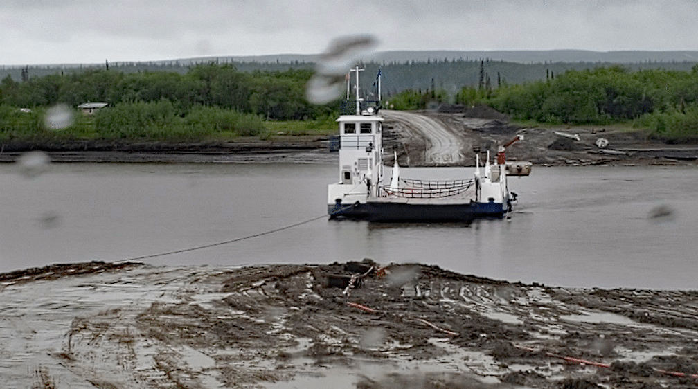
Our first river crossing was the Peel River just south of Fort McPherson. Had we been there a week earlier we would have been forced to drive across the ice, but, fortunately, the ferry was in service. This ferry was a cable ferry; i.e. it was tethered to a cable stretched across the very wide, fast flowing river. Most ferries farther south have concrete landing pads where the ferry drops its ramp. That isn’t the case up here. The ferry arrived and dropped its ramp in the muddy bank. I put the truck into 4-wheel drive and pulled aboard. Getting off was another story. Again they dropped the ramp in the mud. I could feel the front end of the truck, at least 7,500 pounds, sink into the mud. The bank was rather steep, so I had to give it some gas not only to get off the ferry but up the bank. I felt a jolt when the back tires hit the mud but we easily climbed up the bank. I didn’t know until that night that one of the legs of the camper had caught on the ferry ramp when we dropped into the mud and was slightly bent.

Fort McPherson was a collection of small wooden homes. I spotted a lone gas pump outside of a building labeled “hotel”. The gas was still only a bit over $2.00 a liter. Since the US dollar was worth $1.30 Canadian that really wasn’t bad. My experience as a nomad taught me to always carry plenty of gas additive because anything with higher octane than “regular” is often not available. That was the case up here, and my Hemi likes its octane. I went into the hotel to pay. Out of interest I asked room prices. $200/night.
The Peel River ferry was our first ferry for the day. A few hours later we came to the Mackenzie River. The Mackenzie is even bigger, wider and more daunting than the Peel. There was a village we could see to the south but you still had to take the ferry to get there. The ferry was free-floating and did a three-point trip. If you wanted to go to Tsiigehtchic (the village) you got on one side of the ferry. If you were going through to Inuvik you parked on the other side. The ferry labored to work its way upstream (south) so it could float into Tsiigehtchic. It then went across the river and floated downstream (north) to the eastern side of the river.
If you’re wondering how we could have these tremendously long travel days, we were there in mid-June. It never actually got dark. The temperature would drop a great deal when the sun got low on the horizon.
One of the first things Pamela and I bought when we went to Montana were -20 degree sleeping bags. The bunk in the slide-in extended out over the truck cab, so there could be a lot of cold air under the bed. We unzipped our -20 sleeping bags and slept between them. If it really got cold we also had a feather quilt. Max, our dog whom we rescued just weeks before we left, started sleeping between our legs under the covers. He still does that. The sides of the pop-up had zip-outs that made it as though we were sleeping outside which was great most of the time. Despite all, we were never cold. BUT you must go prepared.
Inuvik is a planned town; i.e. the government literally built it and talked the local Indians into moving in. They told the tribe that their village was sinking. A young native woman whom we met in Inuvik told us that the village is still there. It didn’t sink. And the children of those who moved to Inuvik were taken away from their families and sent to the infamous “Indian schools.” As hard as she tried to hide it, we could still see and feel the pain and anger. Inuvik was built on permafrost so all of the normal city utilities were above ground. Large galvanized pipes ran parallel to the dirt streets. Inside were the utility pipes and cables.
Since the road from Inuvik to Tuktoyaktuk had just been completed a little over six months before, we weren’t sure what amenities Tuktoyaktuk would have. Up to this time, people who wanted to go to Tuktoyaktuk had to go either by dog-sled or bush plane. Inuvik had gas for $2.25 (Canadian) per liter, so we filled up and made Tuktoyaktuk a day trip. The 95 miles that wound its way through the massive delta to the Arctic Ocean was amazing, and that’s a tremendous understatement. At one point we got out and stepped onto the permafrost. All along the 1,000 mile road we would see snowmobiles (“snow machines” to the locals) along the road. They were left there when there was no long sufficient snow. The locals prefer winter because you can travel on the snow. We didn’t want to hurt anything but we did want to experience permafrost. Pamela has pictures of me trying to walk. It was like walking on jello.

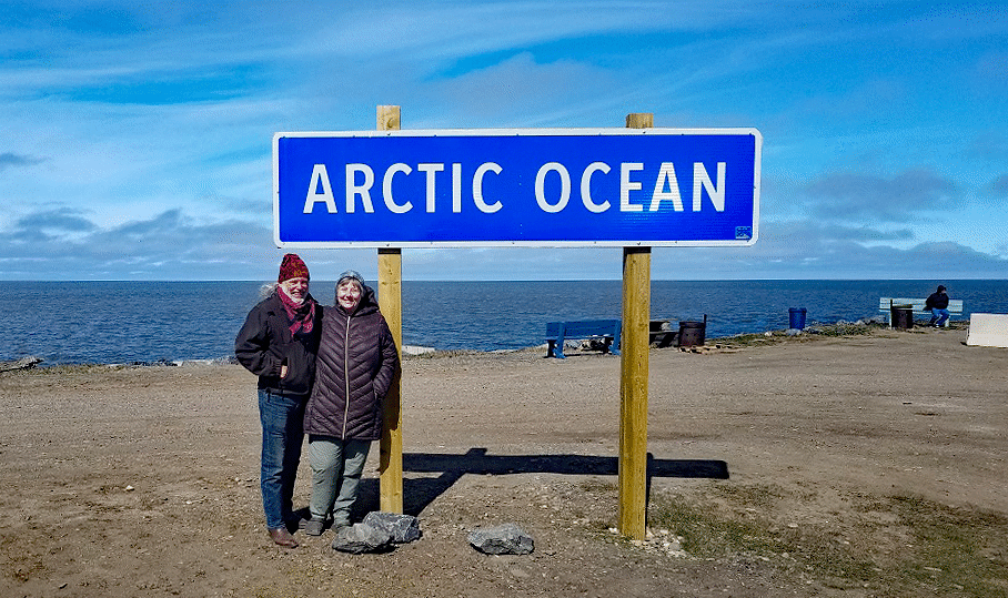
If I hadn’t put on the brakes we would have been in the Arctic Ocean. Since the road opened, the locals put up a little shack as a visitor center. There was no one there, but that was okay. There was a parking area on the ocean with a sign “No swimming or fishing”. That was because this is a sacred site to the natives. We saw one local native family having a picnic on the “beach”. It was probably 40-50 degrees. A lady came along on an ATV and offered to sell us sweatshirts that commemorated the road. She wanted $40 Canadian. It was really a nice sweatshirt. I had Canadian money but I offered her $40 US. Knowing that she was probably selling these for someone else who would get most of the money, I told her that the US dollar was worth $1.30 and that she should take my $40 to the bank herself and exchange it. That would give $12 more just for her. Having been in a local grocery store in Inuvik I knew that would buy a gallon of milk. There was a man on a motorcycle from Arkansas taking selfies with different cardboard signs thanking people for their support. He was dominating the “Arctic Ocean” sign. I offered to help him and learned that he was a cancer survivor and this motorcycle trip from Arkansas was his victory celebration. The pictures were for all of the people who had helped him survive and make the trip. Knowing that we didn’t mind his dominating the sign.
We were on top of the world . . . almost literally.
While we were up there Pamela was reading a book called “The Mad Trapper.” It was a real story and took place along what is now the Dempster. Pamela was reading her book at one of the last places we camped. It turned out that the place being described in the book was across the road.
The round trip took us a week. We went into the visitor center in Dawson City when we got back. The lady wanted to hear all about what we thought and beamed with pride as we shared our adventure. Two months later we were traveling on the famous Alcan Highway and met a woman at a pull-out. We knew she was Canadian and so shared how wonderful we had found the Dempster. She beamed. It turned out that she was the Road Superintendent of the Dempster. She told us about the tremendous work it was to build and maintain. The reason that it was so stable is that they put down a 3 meter (almost 10 feet) pyramid of gravel designed not to melt the permafrost, and built the road on top of that.
The Dempster Highway is many nomad’s dream adventure. In our entire time in Canada and Alaska we were rarely in towns. We only paid for camping three times in over 100 days. One of those times was at Denali because we didn’t realize that there was boondocking nearby and once when we came off the Dempster because the campground had a place where I could wash the truck. Normally we just watched for a river crossing. On each side, near the bridge, would be roads leading down to the river where you can camp. Sadly there is no way to make it a ‘cheap’ trip. Gasoline was $6-8/gallon and food cost were just as bad. We decided to splurge in Whitehorse one day and eat at a restaurant. The restaurant wasn’t fancy but the food was excellent. However, lunch cost us over $50. Live and learn. We only ate out one other time.
I feel compelled to share Dempster with our nomad friends and community. I know that there are many nomads who are nomads because it offers the best possible quality of life on an extremely limited budget. There are also those nomads who do it for the life-style; the freedom and, yes, the adventure. I will be honest. Our entire 100 days in the Yukon, Northwest Territory and Alaska cost us over $12,000 in food and gas. It made a sizable dent in our retirement funds but, honestly, I’d do it again in a heartbeat.

Bob, Thanks much for these stories. We all knew of your travels but its great that you can put into words and photos from memory so we can imagine being there with you. Most of us would never have the chance to make these trips. Keep the stories coming!
This is story is by Russell Vance III, (the man in the photos) not Bob.
Very enjoyable and informative story. Thank you.
Eagle Plains not Eagle Nest is the name of the place on the Dempster if any one is trying to find it on a map. I enjoyed reading your perspective on the Dempster as i live in the yukon and had done the trip to the Arctic Ocean the previous fall. We travelled in september and after a summer of rain the road was not in as good condition.. We get spoiled up here and in Alaska with the many places to boondock but this newsletter has given us insights in where to find great places in the lower 48.
Absolutely love being able to read an adventure experience in actual writing. I have learning disabilities with sound. Reading is such a joy. Thank you for writing this up so beautifully. It goes beyond my wildest imagination about Yukon. I’m in awe.
Terrific post – what a fantastic adventure. Thank you for sharing this!
Wonderful adventure….. Thanks for sharing !
Awesome! What an adventure. Thank you for sharing this.
Russell Vance III, Wonderful, I enjoy reading your adventures from beginning to the end, thank you !!
Brave people for an amazing & startling trip.
Thanks for the good story of your adventure.
Absolutely fantastic!